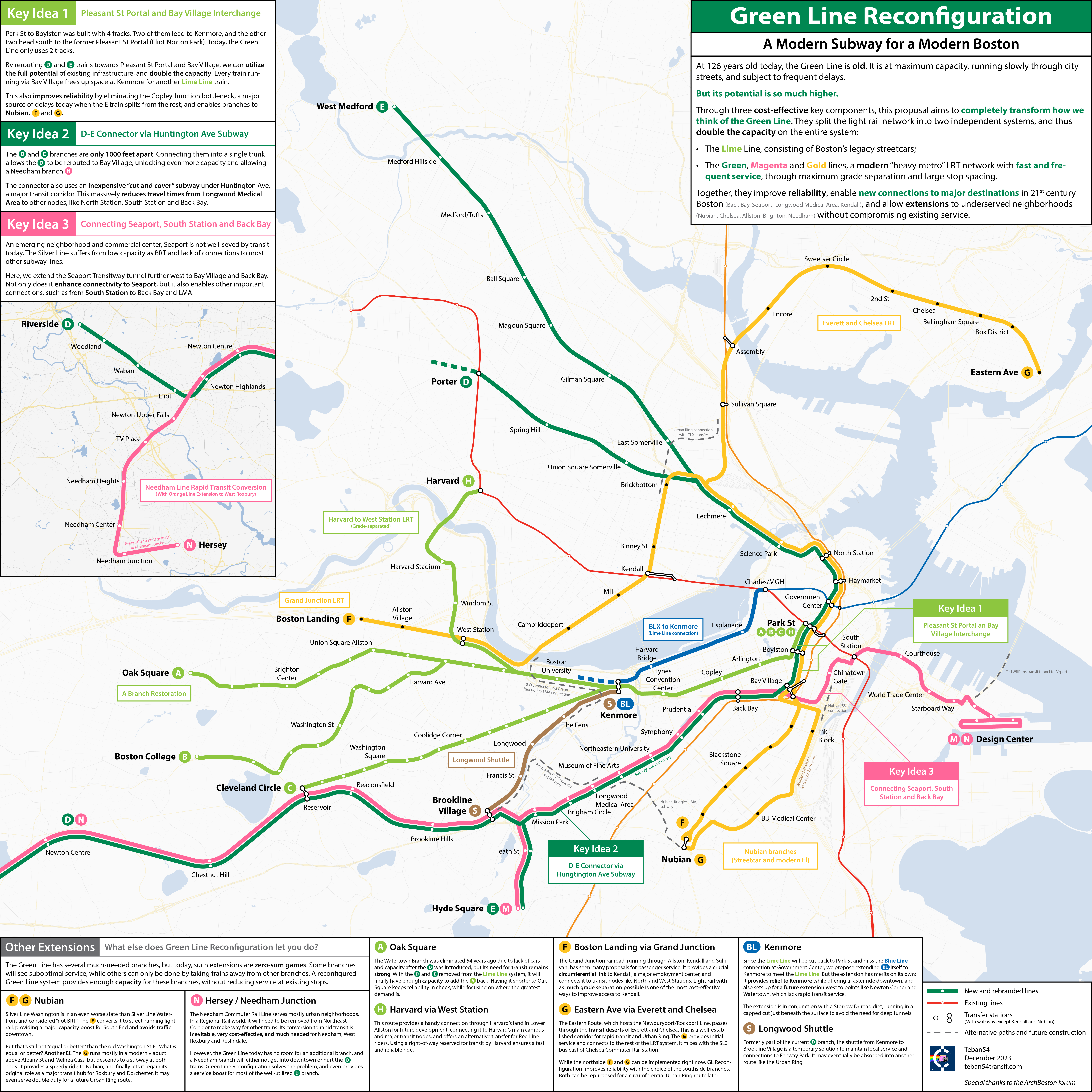
Here is my submission to the Transportation Dreams Challenge by the Leventhal Map & Education Center at the Boston Public Library: Green Line Reconfiguration.

This is a fantasy map on a concept that had been discussed on ArchBoston for almost 10 years. If you want to go down the rabbit hole that’s now 62 pages long, here you go.
As for what GL Reconfiguration is and what its benefits are, I hope the map itself is self-explanatory. I honestly think it’s truly one of the best lines of transit proposals for Boston that I have encountered, yet it is so poorly known to the outside world, especially compared to projects on similar scales (that cost even more) like NSRL and Urban Ring. That’s why I made the map with this particular focus: to “formalize” the idea a bit and make more people aware of it.
Let me know if you have any questions! Here’s an alternative link to the map on Imgur.

Leave a Reply